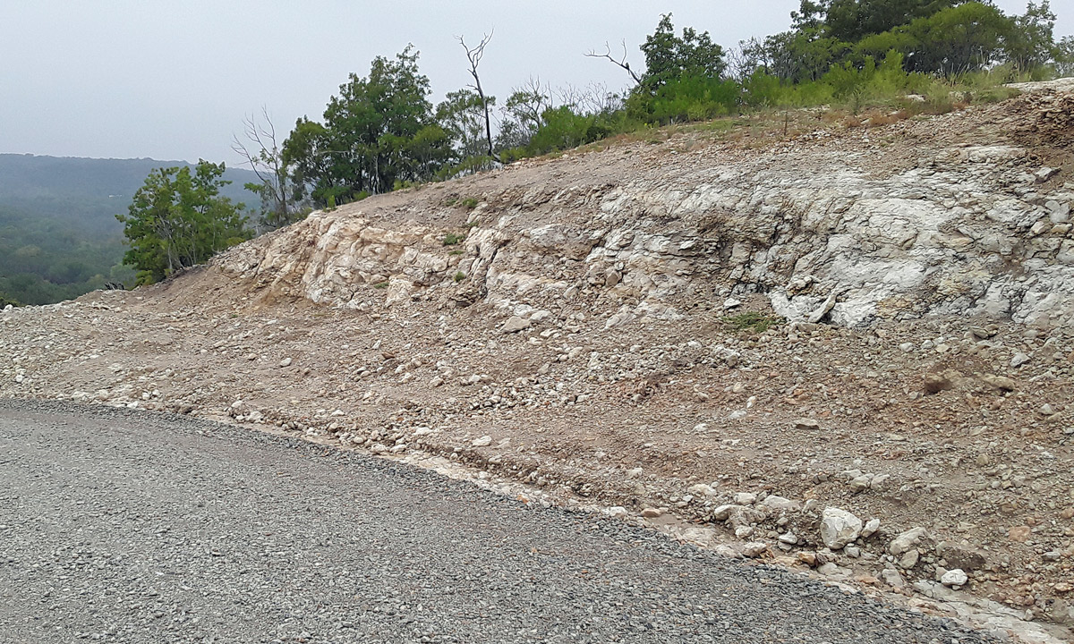
Loc: Johnson County, TX.
16 Sep 2023
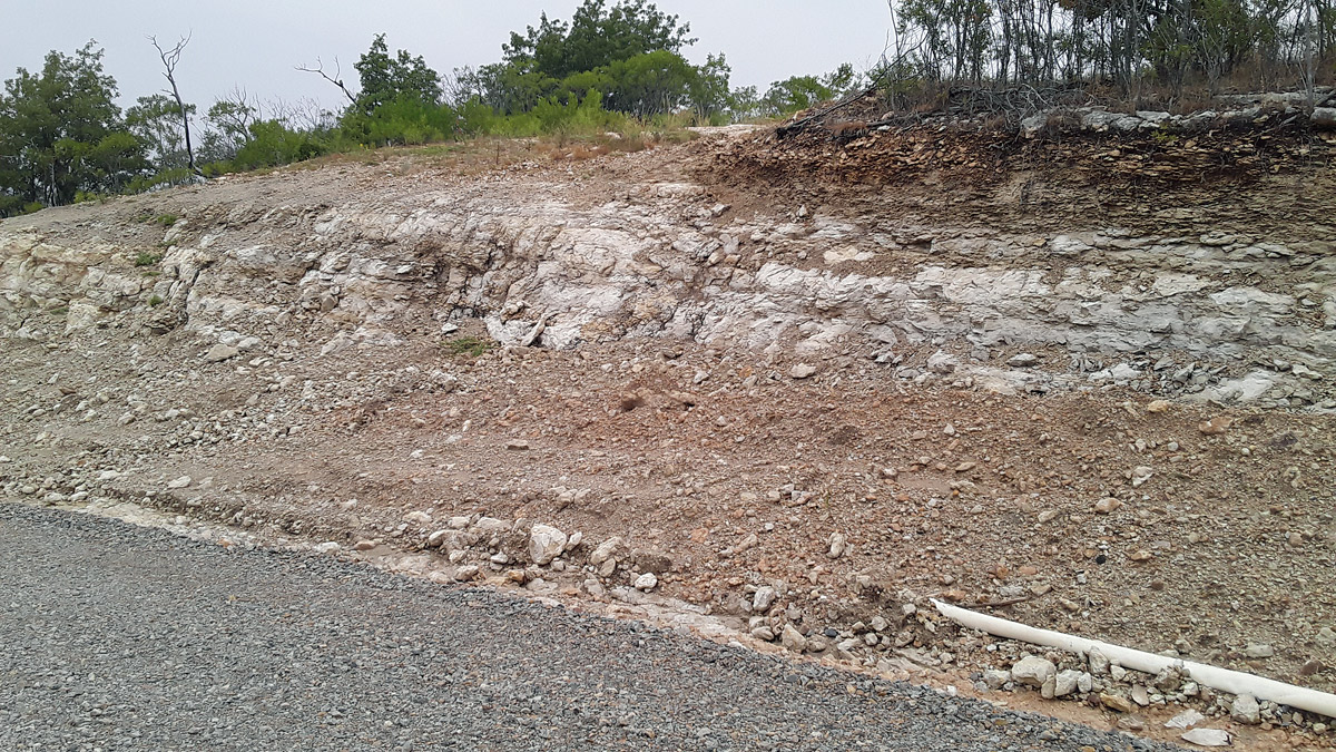
Loc: Johnson County, TX.
16 Sep 2023
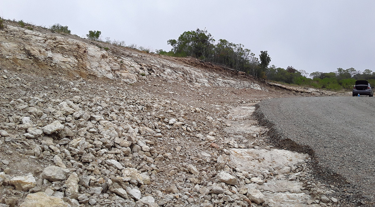
Loc: Johnson County, TX.
16 Sep 2023
|
Loc: Johnson County, TX. 16 Sep 2023 |
Loc: Johnson County, TX. 16 Sep 2023 |
Loc: Johnson County, TX. 16 Sep 2023 |
| The Geology of Texas - Vol. 1
Nomenclature. ---The name Edwards, 36 of Hill and Vaughan (795), replaced the terms Caprina limestone of B. F. Shumard (1463, pp. 583-584), and Barton Creek limestone of Hill (735, p. 5; 751, p. 23). Other local members of the Edwards near Austin are the "Flag limestones" (lithographic horizon), the "Austin marble" (Caprotina horizon), and the "chalky limestone subdivision" (735, pp. xix-xxii). The type locality of the Edwards is on Barton Creek near Austin. Stratigraphic position and contacts. ---From Fort Worth to south of Waco, the Edwards gradually thickens, and is overlain, apparently unconformably, by the Kiamichi clay. South of Waco, the Kiamichi is absent, and the Edwards is overlain by Duck Creek limestone. The Edwards-Duck Creek contact shows evidence of unconformity in Bell County (16, p. 40). Its lower contact with the Comanche Peak is continuous and gradational where it has been recorded. Facies. ---(1) Marginal facies exists at Sierra Prieta north of Sierra Blanca, where brown cross-bedded sandstone containing Alectryonia cf. carinata and other poor casts composes the section below the basal (Hamites-Desmoceras) zone of the Duck Creek limestone. In the Rycade Chittim No. 2 well in eastern Maverick County, 20 feet of coarsely crystalline rock salt is recorded (578, p. 1426), presumably near the top of the Edwards, with 779 feet of limestone between it and the Del Rio clay. In nearly pure, heavy bedded limestones, in the southern part of the Edwards Plateau, fossil logs are recorded (578, p. 1427) :a dicotyledonous log 18 inches in diameter near Mine Creek, northern Uvalde County; a palm-like log 20 inches in diameter near Barksdale, southeastern Edwards County. Silicified wood also occurs in basal Edwards in southern Real County. It is not known whether these logs floated to their present locations, or whether they indicate proximity of the marginal facies. (2) Neritic facies occurs in the form of marl at Fort Stockton, here called University Mesa marl. Marly limestone occupies the top of the Fredericksburg at many places (El Paso, Round Rock). (3) Reef limestones and associated rocks compose the typical Edwards; these rocks, diverse in lithology, are discussed below. Dr. Decker has recently discovered a rudistid (caprinid) deposit in the Fredericksburg in southern Oklahoma, the northernmost known in this longitude. Areal outcrop, local sections. ---The northernmost recorded Edwards is at Fort Worth, where a few feet of crystalline, thin- to medium-bedded limestone contains masses of undetermined caprinid casts (Gayle Scott, personal communication) ; at Benbrook a rudistid was reported in the top of the Goodland (1575). Hill considers the Edwards to be 4 feet thick here. It is harder, more crystalline, and more prominently cliff-forming than the underlying Comanche Peak. In southwestern Johnson County, about 35 feet of Edwards is recorded. In the cap of Comanche Peak 33 to 35 feet remain, of which the upper 3 feet contains Eoradiolites davidsoni and Chondrodonta munsoni. The formation is composed of layers of hard white limestone, each from 3 inches to 10 feet thick, below which is a massive bed 15 feet thick, forming the main upper scarp of the peak. In Hill County below Blum, the Brazos has cut tall cliffs capped by Edwards, which continue downstream across Hill County. The Edwards is 50 to 75 feet thick, and consists of rudistid limestone, a hard, crystalline, medium-to-massive-bedded, white limestone, composed of considerable calcareous shell detritus and some precipitated limestone. It contains Eoradiolites, Chondrodonta, Toucasia, Requienia, caprinids, Pecten, and other reef forms. This limestone is exposed in Nolands River just north and west of Blum, and in road cuts south of the town. Tall cliffs occur along the Bosque Valley east of Clifton and around Valley Mills. In the upper strata of nearly pure, white, crystalline reef limestone, abundant rudistids occur, as Caprina crassifi.br a Roemer, Caprinula anguis (Roemer) , Eoradiolites spp., Toucasia texana (Roemer) ; and Chondrodonta munsoni (Hill), pelecypods, and gastropods. At localities on the Meridian Highway 2 to 3 miles east of Valley Mills, the Edwards consists of alternations of whitish nodular limestone, with the usual upper Fredericksburg fauna of pelecypods and gastropods, and massive, harder, crystalline reef limestone with rudistids. Caves and rock shelters nearby contain many rudistids. In one of the softer layers east of Valley Mills, the plicate inoceramus, Actinoceramus subsulcatiformis Bose, was found. Other fossils include Exogyra texana Roemer, Lima wacoensis Roemer, Cardita, Gryphaea marcoui Hill and Vaughan, Engonoceras, and species of Oxytropidoceras. In facies, this soft, marly upper Edwards is similar to that at Round Rock; the top of the Edwards in Hill County is uniformly a massive pure limestone with a tangle of Caprinidae, rudistids, Chondrodonta, and other reef dwellers. In McLennan County, the Edwards is massive, pure (99.4% CaCO 3), unstained, rudistid limestone. An excellent exposure, studied and collected by Dr. T. W. Stanton about 1890, is at the west crossing of Bluff Creek, 3.5 miles northwest of Crawford, where the limestone is 60 feet or more thick. The exposures consist of alternate, medium-bedded harder projecting and less resistant receding, pure, white limestone ledges. They contain much calcite, and so little iron that the exposures show practically no ferruginous stain. A few ledges at the top are softer. The limestone is a shell debris, as in the reefs west of Belton and at Oglesby. The Edwards here contains a large typical fauna, including Caprina crassifibra, Caprinula anguis, Plagioptychus? cordatus Roemer, Eoradiolites davidsoni (Hill), Radiolites{?) sp., Toucasia texana, Toucasia sp., Caprina sp., Caprotina sp., Chondrodonta munsoni, and others (11, pp. 35-37) . The Edwards also outcrops in McLennan County along Middle Bosque River, from a point 2 miles west of Windsor northwest to the Bosque County line, including the area east of Crawford and along Bluff Creek. West of its reentrant down North Bosque River at Valley Mills, the outcrop turns westward and follows down Leon River across western Coryell County to Belton. At Patton, in the bed of Hog Creek, the basal Duck Creek and 3 feet of Kiamichi marl occur; beneath them is the top layer of pure reef limestone with the rudistids mentioned above. On the Meridian Highway, 0.4 mile west x of the McLennan-Bosque county line, beneath about 9 feet of Kiamichi marl, the top of the Edwards, with similar lithology and fossils, is exposed. In the creeks about a mile east of Crawford, the same contact is exposed, and beneath it, about 25 feet of fossiliferous Edwards. In the bed of North Bosque River, 3.5 miles southwest of China Springs, beneath 4 feet of Kiamichi, a few feet of uppermost Edwards occurs (11, p. 40). In Middle Bosque River, 2 miles west of Windsor, about 25 feet of upper Edwards, consisting of alternate reef and gray nodular limestones, occurs. North of Bell County, the Edwards lithology shows three main types: soft, nodular, marly, gray limestone and marl with non-reef pelecypods, gastropods, and echinoids; harder chalky-gray limestone with slight clay content, and a non-reef fauna; and pure dazzling white, calcitic, limestone, hard to friable, much of it composed largely of shell debris and precipitated lime, with a reef fauna. From Bell County southwards other types appear. Here the formation caps the upland west of the Balcones fault zone, running from Leon River west to Sugar Loaf Gap north of Killeen, along the north county line. In the northwest quarter of the county it forms a large upland, deeply cut to the soft Walnut clay in the valleys of streams flowing down-dip. A broad plain is formed by the valley of Nolan Creek, west of Belton. In the southwest quarter. of the county the main Edwards outcrop narrows to a few miles in width, and forms the back slope of a long cuesta running eastwards from the valley of Lampasas River. These Walnut valley interstream divides, buttes (outliers), and the west-fronting cuesta face of the Edwards-Comanche Peak scarp, compose the Lampasas Cut Plain of Hill. It is notable that late movements in connection with the Balcones Fault have produced typical intrenched meanders of considerable depth in Bell County (as Leon River) and McLennan County (as Bluff Creek) ,by rejuvenating the streams and increasing their gradients. The Edwards here, and generally, is distinguished from the underlying Comanche Peak facies by having: (1) persistent strata of limestone, even-bedded and medium-to-massive in thickness, instead of compressed chalky limestone nodules with a subordinate amount of marly matrix; (2) flint, in nodules and in thin strata; (3) rudistids and caprinids, of the genera Toucasia, Requienia, Monopleura, Caprina (these four occur also in the Glen Rose), Caprinula, Caprotina (?), Plagioptychus (?), Planocaprina (?), Polyconites (?); Praeradiolites, Eoradiolites, Sauvagesia, and others; (4) other reef -dwelling fossils, as those from the Edwards described by C. A. White and F. Roemer, most of them apparently zone fossils: Chondrodonta munsoni, Phacoides acute-lineolatus, Trochus texanus, Cladophyllia furcifera, and others; (5) reef limestone: a nearly pure, white or light gray detrital or fragmental shell coquina and associated precipitated calcium carbonate, composed mainly of comminuted shell fragments, and containing much calcite as shells and as free masses; (6) other kinds of limestone, whose exact mode of deposition has not been investigated, as miliolid limestones, sandy limestone, and sandy, limy clay, both finely laminated, silty layers; and (7) pulverulent layers of finely divided, nearly pure, calcium carbonate, produced by intraformational solution and redeposition, and, associated with it, disintegrated remains of "honey-comb" limestone from which much of the lime has been dissolved. These pulverulent layers are at places associated with anticlinal structure; they occur on the Kolls place west of Belton, on Barton Creek and in Deep Eddy Bluff at Austin, in numerous caves near Crawford, Valley Mills, Austin, and in the Edwards Plateau and canyon region of the Pecos and Rio Grande valleys. Rudistids become disengaged in such weathering layers and occur free in large numbers. The pulverulent limestone has been used commercially on a small scale; the honeycomb rock, from Glen Rose, Edwards, and other formations, is locally used as ornamental stone. A soft formation, called "adobe," occurs near the top of the Edwards in central Texas, and forms the producing horizon in the Luling oil field. In Bell County the top of the formation is a pure white rudistid reef limestone, as farther north. However a few thin layers interbedded with the limestone are composed principally of flaky, yellow, shelly marl, containing the same fossils as the adjacent limestones, Pecten duplicicosta, Chondrodonta, Praeradiolites, Eoradiolites, Goniopygus cf. zitteli, corals, and other fossils. The base of the formation consists of a widespread, soft, water-bearing siltstone, weathering yellow, and containing few fossils except casts of Planocaprina (?) and other caprinids. The middle of the formation contains several limestones associated with the purer coquina and Requienia-limestones : (1) a dense, ringing, fine-grained, medium- to thin-bedded limestone, light bluish-gray or dull buff gray, with faint salmon-reddish cast or streaks, which contains numerous imbedded small calcitic fossils, visible as cross-sections on fracture. This rock is mostly non-siliceous, but locally contains flints. It has a prominent conchoidal fracture, splits easily, and is a good building stone. In texture it resembles fine-grained Ellenburger limestone. (2) A prominent type is a shell coquina of rudistids, caprinids, gastropods, pelecypods, corals, echinoids, and other fossils, cemented into a porous or cavernous mass of shell agglomerate and debris. This rock is a part of the rudistid reef facies. At some places it is entirely calcareous, and may be sawed into building and paving stone. It is full of cross-sections of rudistids, caprinids, Nerinea, and other gastropods. At other places the fossils are partially silicified, and the matrix, only slightly so, decomposes into a very ferruginous clay, disengaging the fossils upon weathering. The rock and clay bear considerable iron, and weather to a dark red color. The fossils include foraminifera. (Haplostiche texana, Orbitolina, and others), many gastropods, corals, caprinids, and rudistids. (3) A common type, excellently exposed at the Santa Fe quarry 3 miles northwest of Belton, is a coquina of comminuted shell fragments, with many entire shells, of the rudistid reef facies. It is a white or light bluish-gray, entirely crystalline, rather soft calcareous deposit, with a composition of 3% or less of silica, and the rest practically pure calcium carbonate. Prominent fossils are foraminifera, corals, caprinids, rudistids (Eoradiolites, Polyconites?), pelecypods (Plagiostoma, Lima, Pecten), gastropods, echinoids, bryozoa, worms, corals, and other groups. In Williamson County, the Edwards is thicker, and locally is used for building stone and for lime manufacture. Hill (803, p. 236) gives a thickness of about 230 feet for the Edwards near Round Rock. A persistent sulphur water horizon occurs near its top. The top is well displayed in Brushy Creek at Round Rock near the Balcones Fault. Beneath the Duck Creek member of the Georgetown limestone, there is 5.5 feet of gray-blue marl with Oxytropidoceras supani (Lasswitz) ,Tylostoma sp., Exogyra texana Roemer and other fossils, an upper Fredericksburg fauna. Taff (1574, p. 344) considers this stratum as Kiamichi, but classifies the Kiamichi as of Fredericksburg age. Pending the discovery of diagnostic Kiamichi fossils at this locality, the identification with Kiamichi will have to remain in doubt; but in any event, the Kiamichi is very close in age to upper Edwards, differing largely in the presence of Gryphaea navia and a few other zone fossils; Oxytropidoceras supani apparently occurs in both the Kiamichi (Fort Stockton) and the upper Goodland (southern Oklahoma), but this genus requires intensive study before this upper Fredericksburg group of fine ribbed species can be used for minute stratigraphic distinctions. The thin uppermost clay is underlain by a Toucasia-Requienia reef, about 5 to 10 feet thick, a massive limestone, in which are cemented innumerable rudistids. The upper one-third of the Edwards contains at least four zones of rudistid limestone; in the upper reef limestone, 6 feet below the top of the Edwards, is an abundance of Eoradiolites, and at a level about 50 feet below the top, both here and at Austin, a main level of Chondrodonta. The middle one-third of the limestone is non-reef limestone, and contains several prominent bands of flint nodules; the lower one-third contains in addition to the hard, gray limestone, with strong conchoidal fracture, at least one band of reef limestone. Near Austin, the Edwards is 300 feet thick or more (808, 1429) . Its upper one-third contains at least four levels of reef type of limestone and a prominent flint band. Its middle one-third contains mostly non-reef limestone and several flint bands. Its basal one third contains four or more reef bands and basally some sandy strata. A widespread sulphur water horizon is located near the top of the Edwards. Requienia and Toucasia are present from top to bottom of the Edwards, and in the Glen Rose. Local correlation can be based on intervals and on the presence, in various horizons, of flints of characteristic shape or size. The Edwards limestone caps the highest summits of the Callahan Divide, and extends westward to the cap of the Llano Estacado. In both these areas it possesses its typical lithology, flints and some characteristic fossils. In Comanche Peak, Hood County, it is 35+ feet thick. At Logan's Gap, Comanche County, Hill (803,, p. 205) gives 83 feet, and at Round Mountain, 44+ feet. In all the thicknesses listed below, the Edwards outcrop is obviously remnental, but in some, as Comanche Peak, certain points on the Callahan Divide, the Llano Estacado, and in Double Mountain, the present cap is probably near the top of the Edwards, because of the reported presence of forms like Eoradiolites davidsoni, Praeradioliies, and Chondrodonta munsoni, which seem restricted to upper Edwards. In the Baker Mountain section, Callahan County, the combined Comanche Peak and Edwards limestones aggregate 110 feet, which included the basal part of the. Edwards (1574, p. 321). In the Buffalo Gap section, Taylor County (Abilene sheet), the heavily bedded Comanche Peak and the Edwards aggregate 130 feet, of which Taff assigns 20 feet or more to the Edwards. Mrs. Kernp37 states that the Edwards in this district consists of 20 to 50 (at most places 20) feet of medium hard, cream colored limestone, containing Toucasia texana, T. patagiata, Caprina sp., C. planata, C. crassifibra, and other fossils, overlying 60 to 80 feet of Comanche Peak, which is composed of an upper, hard, massive limestone, a medial, soft, yellow clay (4 feet), and a basal, hard limestone (14 to 16 feet). Church Mountain, Taylor County, is stated to have 75 feet of Edwards, massive chalky limestone above and below with intervening bedded limestone, and with flints in the upper part of the section (1574, p. 323). In the Horse Mountain section, Taff records 60 feet of massive chalky limestone, with bands of large flint nodules near the center. In Stepp Mountain, Coke County, 55 feet of Edwards remains (841, p. 107) ;in Mt. Margaret, about the upper 23 feet is Edwards; in Mount Q 45% feet; in southwest corner of Cole Mountains 112? feet; in south end of West Stepp Mountain 50 feet (92, pp. 53-59). Much of this limestone is crystalline, calcitic, and flint-bearing, and some ledges contain caprinids, Eoradiolits, and other radiolites, gastropods, foraminifera, and other fossils. In the southwest corner of Table Gap Mountain, northeastern Runnels County, there is exposed about 40 feet of Edwards, containing caprinids, cylindrical sponges or algae, and large fossils (87, pp. 50-51). In various exposures in Tom Green County, the Edwards, with caprinids, reaches 200 feet in thickness. The cap of Double Mountain, Stonewall County, an erosional remnant from the Llano Estacado, consists of 40 feet of Edwards, containing various forms of Caprina and "many Hippurites" of large size (467, pp. 347---351 ). Baker collected a new species of Praeradiolites from this locality, and probably Eoradiolites and other radiolites are present. For Edwards fossils on the Llano Estacado, see pages 355---358. The Edwards in northern (400-500 feet) and southern (724 feet) Bexar and Medina (460 feet) counties, retains its chief lithologic characters, but westwards it and the Georgetown limestone form one lithologic unit. The Edwards was described from the canyons of the Nueces; in the Nueces quadrangle, 628 feet is recorded, in the Uvalde quadrangle, 520-j- feet (1686, p. 1). In the Southern Edwards Plateau, in the upper Edwards, Kingena wacoensis and Ostrea cf. subovata are recorded, which may suggest that the upper part of this formation is of Georgetown age. In the lower Pecos canyon, at the bridge on the Del Rio-Sanderson road, the entire visible limestone section is stated (1524, p. 406) to be of Georgetown age. Throughout Brewster and Presidio counties, below the Southern Pacific railway, the Edwards retains the same facies and thickens southwards. In the Solitario rim it has a thickness of 800 feet or more, south of Terlingua, an estimated thickness of 1000 feet. In these sections it has essentially the same lithology as in the lower Pecos Valley. In the Fort Stockton area, the top of the Fredericksburg beneath the Kiamichi marl (Edwards equivalent) is a fossiliferous marl, here called University Mesa marl. It is about 50 feet thick, is underlain by Comanche Peak limestone, and overlain by a thin brown limestone seam, above which the Kiamichi marl occurs. At Kent and El Paso it is clay and marly limestone, and at Sierra Prieta, north of Sierra Blanca, the entire Fredericksburg is crossbedded, brown, fossiliferous sandstone. Lithology.---The Edwards reef and associated limestones are generally light gray, crystalline, coarse-grained, organic, nearly pure limestones, with much calcareous shell detritus. Its appearance has been described previously (pp. 341-2). Microscopically, the Edwards shows much diversity. The dense, sparsely detrital layers have a finely crystalline matrix, and few foraminifera or other shelly material. A common Edwards type is the miliolid limestone, a compact rock with finely crystalline, clear, calcite, matrix, in which are imbedded innumerable miliolid foraminifera of a complicated type, somewhat resembling Massilina. This rock occurs at certain Edwards levels, but locally the type contains admixtures of shelly material. Miliolid limestone is practically confined to reefy Fredericksburg in southern Texas, and in Mexico is known from northern Coahuila, southwards in the El Abra limestone of the Front Ranges, underground in the South Fields, along the mountain front west of Orizaba, to the Isthmus of Tehuantepec. It is abundant in the quarry (type locality) at El Abra, and occurs more sparsely in the nearby Taninul (rudistid) limestone. Miliolids are sparse in the Tamasopo limestone. Some strata show a fine, granular, calcite matrix nearly devoid of fragments; some are practically pure miliolid limestone, with a clear calcite matrix (fig. Hanna, 647a, pi. I, figs. 3, 7) ; some are mixed miliolid and shelly material; some consist of shelly detritus practically devoid of foraminifera (op. cit., pi. 11, fig. 7). Hanna (647a, pp. 51-53, pi. I) gives analyses and figures of thin sections of several Edwards core samples. Some cores show only slight dolomitization, 0.3% or less of MgO. Analyses of the "adobe" lime in the upper Edwards show MgO present, from a trace up to 11.1%; and other limestones from Edwards show nearly complete dolomitization, having 33.3% of CaO and 18.3% of MgO. Subsurface extent.---From drillers' logs, it is impracticable to separate the Edwards, but lithologically it is generally recognizable. Many thin sections show shell fragments, some show a dense, fine-grained, nearly homogeneous, calcitic material, with scattered sections of fossils, some show sparse or densely packed slices of miliolid foraminifera. These features generally distinguish it from adjacent formations. Its thicknesses and features in the Gulf Coastal Plain have not been extensively studied. General thicknesses are: southern Bexar County, 724 feet; Uvalde County, 586 feet; Maverick County, 905 feet (1681, p. 253) ;near Mexia, 100 feet or less; in East Texas a considerable thickness of undifferentiated Fredericksburg rocks. Paleontology and zonation.---No complete zonation of the full thickness of Edwards has been published; facts about zonation are given on page 327. The reef limestones of Fredericksburg and Washita are distinguished in several features: their lithology shows an abundance of coquina, shell fragments, precipitated massive limestone, chert; rudistids are abundant locally and in certain strata, ammonites rare, or present largely in the marly interbeds; pelecypods are of a special type (fluted Pectens, Chondrodonta) ; gastropods are of special types (Nerinea, Actaeonella) , echinoids are of special types (as Goniopygus) ; corals are of special types (as Cladophyllia and abundant compound types) ; there are special types of verticillate algae (as Cladopolia) . Economic products. ---The Edwards produces oil at Luling; it has local and weak water horizons; produces quicksilver, and in lesser amounts, silver and other metals; limestone for lime, Portland cement, building stone, and road metal; and contains small amounts of gypsum, anhydrite, celestite, strontianite, and other nonmetallics. At many places near the outcrop, but especially down-dip, the Edwards is a prominent artesian water horizon. 36This and the following lists of ostracoda
were kindly furnished by Dr. C. I. Alexander. sa |