| Last Update 21 Jan 2025 |
|
NACATOCH FORMATION Nomenclature. -- The type locality of the Nacatoch62 sand, described by Veatch (1691, p. 27) is Nacatoch Bluff, on Little Missouri River, Clark County, Arkansas, where a 50-foot section is exposed. Synonyms in Texas are: Powell sand, Campbell sand, and probably Minerva sand; and from Hill's description (803, p. 342), the Nacatoch sand appears to compose the upper part of his "Corsicana beds." Synonyms in Louisiana are: Caddo sand, Vivian sand, Shreveport sands. Outcrop. -- The Nacatoch outcrop extends westward across the northern tier of Texas counties, Bowie, Red River, northern Delta, and turning southward with other Gulf outcrops in eastern Hunt County, passes through Kaufman and Navarro counties to northern Limestone County. Underground the Nacatoch is widespread in northern Louisiana and in the East Texas embayment, though its exact subsurface extent is not yet securely known. In northwestern Louisiana it is an extensive gas-bearing horizon. The upper sand in the Bethany gas field, the sand in Eldorado* the producing sand in the Mexia-Groesbeck gas field, the oil sand in the Powell field, the heavy oil sand in the Corsicana field, and the Minerva sand in northern Milam County, are supposed to be nearly or exactly equivalent to the Nacatoch. The fields along the Mexia fault zone where the Nacatoch has produced oil or gas are listed by Lahee (969, p. 360). Red River County to Hunt County. -- In the Caddo oil field the thickness of the Nacatoch ranges from 100 to 200 feet, part of the difference being caused by the northward and westward thickening of the formation (1059, pp. 23-25). It is composed of light gray to greenish fine sand, alternating with layers of indurated sandstone and thin layers of clay. Locally the formation contains glauconite or calcareous filling or cement. Shale, gumbo, and indurated fine sand occur in lenses. The Nacatoch here bears gas and salt water. Westward across Panola County (859, p. 190;1408, fig. 1) the Nacatoch thickens from a small amount to about 225 feet. Stephenson records in northeastern Texas about 100 feet of Nacatoch, consisting of fine gray sands and more or less sandy clays 62 literature. -- Arkansas: Dane, 392; Veatch, 1691, p. 27. Louisiana: Howe, 850 (bibliography); Veatch, 1691. Northeast Texas: Dane and Stephenson, 391; Lahee, 969; Matson, 1059, 1060, 1062; Powers, 1248, 1252; Stephenson, 1530, 1534; Fohs and Robinson, 543; Shumard, 1469; Hyatt, 866; Sellards, 1408; Hull and Spooner, 859. (1530, p. 157). Fohs and Robinson (543, PL XIII) record the following sections of Nacatoch: in the Paris-Ripley-Sulphur Springs area, 140 feet of hard sandstone and muddy sands; in the Terrell-Wills Point section, 150 feet of hard, water-bearing sands, each 5 to 35 feet thick, and sandy shales; in the Bethany field, 150 feet of gas sand; near Corsicana, 270 feet of sand and sandy shale, some of it glauconitic. In Anderson County (1298, p. 542) from 350 feet above the top of the Pecan Gap chalk down to near the top of that chalk, there occur sand, sandstone, and sandy shale, and locally interbedded thin limestones and shales, which have been correlated with the Nacatoch, and which in Cherokee County give good showings of gas. In Hunt County the Nacatoch strip passes west of Campbell and Dixon and near Cash and Quinlan. In a stream cut on the M. K. & T. Ry. about 3 miles east of Greenville the writer has collected, in a sand and sandy clay, abundant middle Navarro fossils, including Exogyra costata (narrow, elevated ribs), Pycnodonta aff. vesicularis, Trigonia, Pecten, Eutrephoceras and gastropods. In Kaufman County the Nacatoch outcrop passes just west of Terrell and Kaufman. Navarro County. -- The narrow Nacatoch outcrop passes through Chatfield, the western edge of Corsicana, near Pursley, east of Corbet and thence to a point east of Cooledge, northern Limestone County. The thickness in wells near Corsicana is about 200 feet. Matson and Hopkins (1062, p. 218) state that locally the sand is firmly cemented by lime to form hard, dense, calcareous sandstones or irregular shaped concretions. The sand ranges from medium grained to very fine grained and contains glauconite, which is more abundant in some beds than in others. Most samples of the sand are described as fine grained or very fine grained, greenish gray or dark gray, calcareous or argillaceous, and glauconitic; some are hard; a few levels in the formation are fossiliferous. A subordinate amount of dark gray, sandy, calcareous clay is present, apparently in lenses. B. F. Shumard (1469) named the Navarro formation and described many fossils collected near Chatfield and Corsicana. Dr. T. W. Stanton collected in the same area about 1890, and some of his fossils were described by Hyatt (866). In recent years the region has been extensively but unsystematically collected. The Nacatoch outcrop crosses the Rice-Dallas Federal highway No. 75 about 2.75 miles north of the T. & B. V. Ry. underpass in Corsicana, and here there occur sands containing large concretions with fossils (Baculites, Inoceramus, Turritella). In northern Navarro County there are many Nacatoch outcrops; fossils occur at the Negro cemetery 1 mile north-northwest of Chatfield, and in concretions on the Hervey Lake road 2.1 miles northeast of Chatfield. From these localities Miss Gene Ross and others have collected numerous Nostoceras, Helicoceras, Oxybeloceras, Baculites, lnoceramus and gastropods. Limestone County. -- On the outcrop the Nacatoch is thin or absent; it has been reported to be thin near Cooledge. Passing underground down-dip it thickens considerably. Matson (1060, pp. 81, 89, 92) states that in the Mexia-Groesbeck area the Nacatoch has a thickness of 40 to 65 feet, and averages 40 feet, excluding the cap rock. The sand contains locally partings or lenses of shale, most of them 3 to 4 feet thick but some as thick as 10 feet. The sand is mostly fine grained, light gray quartz sand containing many grains of glauconite. Its top is generally cemented into a denser, firm sandstone, which forms a cap rock 1 to 10 feet (average 5 feet) thick. Beneath the cap rock the sand is porous except for layers and lenses of clay. The amount of pore space in samples tested ranges from 16.6 per cent to 34.2 per cent, and averages 25.5 per cent. From the uniform decline in pressure throughout the field it is assumed that the amount of porosity is maintained over a wide area. Lahee (969, p. 327) states that "a few hundred feet below the disconformity (top of the eroded Navarro) is a zone of shaly sands and true sands, more or less glauconitic, forming the Nacatoch sand member of the Navarro. In some localities, notably near Richland, the upper Navarro clays become progressively more marly downward, changing into a thin, hard limestone layer which caps the Nacatoch sand zone. This sandy zone ranges from 150 to 250 feet in thickness. It is not the same in all places, but as a rule contains one or more distinct sands, which may carry water or, on favorable structure, oil or gas." The Edens sand (1062, PL XX) lies near the Taylor-Navarro contact, and is thought to be the same as the Chatfield gas sand. As explained earlier, the "Corsicana" sand in the Taylor of this area is probably the Wolfe City sand. Specimens of Ostrea owenana Shumard were identified by Stephenson from the glauconitic gas sand in the Mackey well near Mexia, and it is stated that the sand "probably corresponds in age to and may be physically continuous with the Nacatoch sand" (1060, p. 80). Milam County. -- The Minerva sand, lying about 110 to 120 feet below the local top of the Navarro, consists of rounded quartz grains, and is generally 3 to 10 feet thick with a maximum thickness of about 15 feet. |
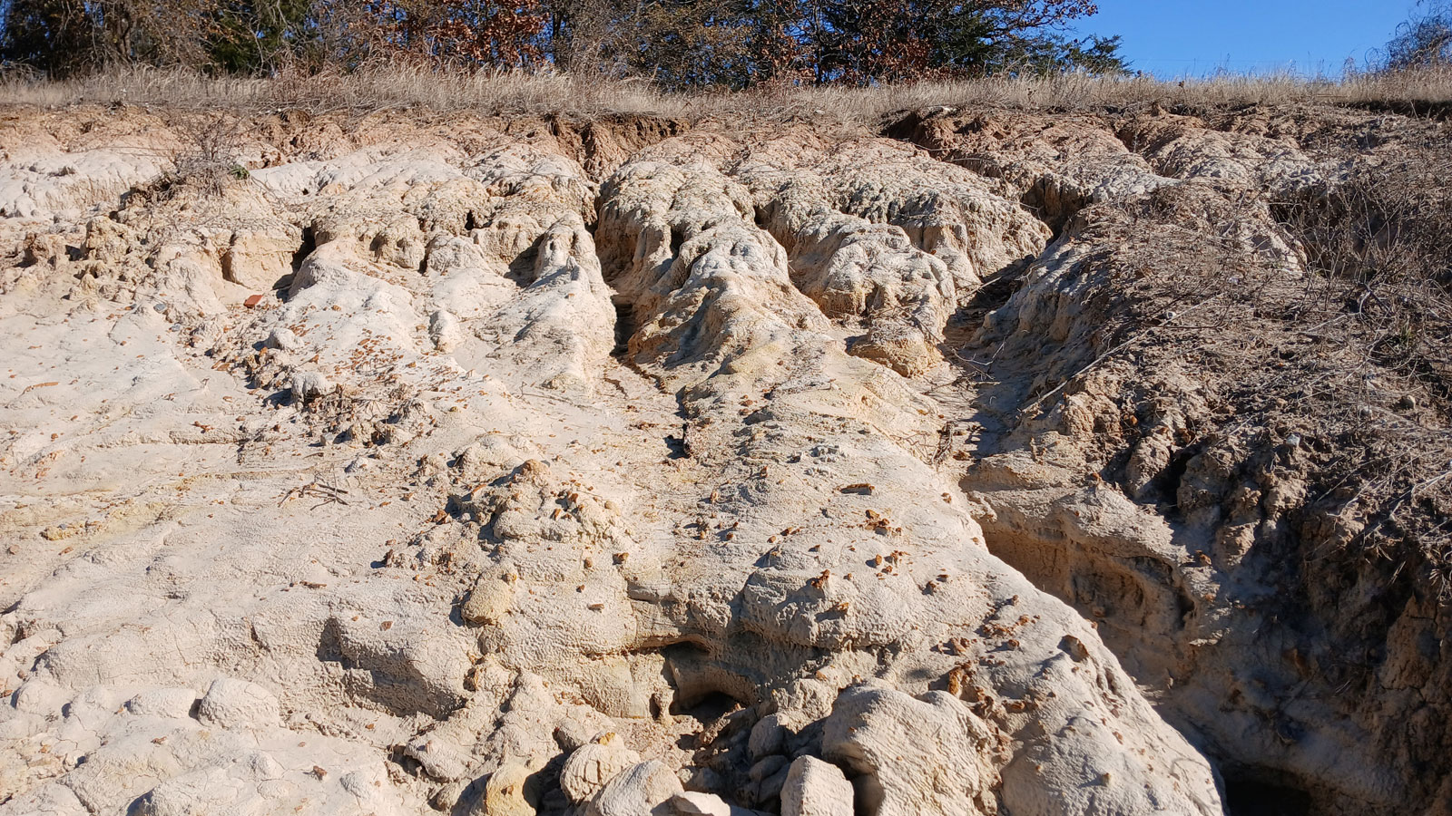
| Commercial sand quarry |
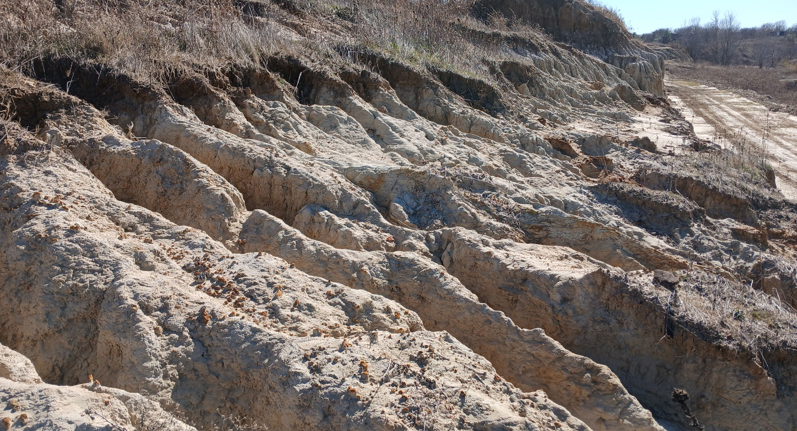
Commercial sand quarry |